Site Selection
Compare and analyse locations
with geodata


Dashboard with descriptive KPIs
We combine your business data with GIS data from the environment creating a Location Intelligence solution and then go on to review, compare and create reports based on updated data.
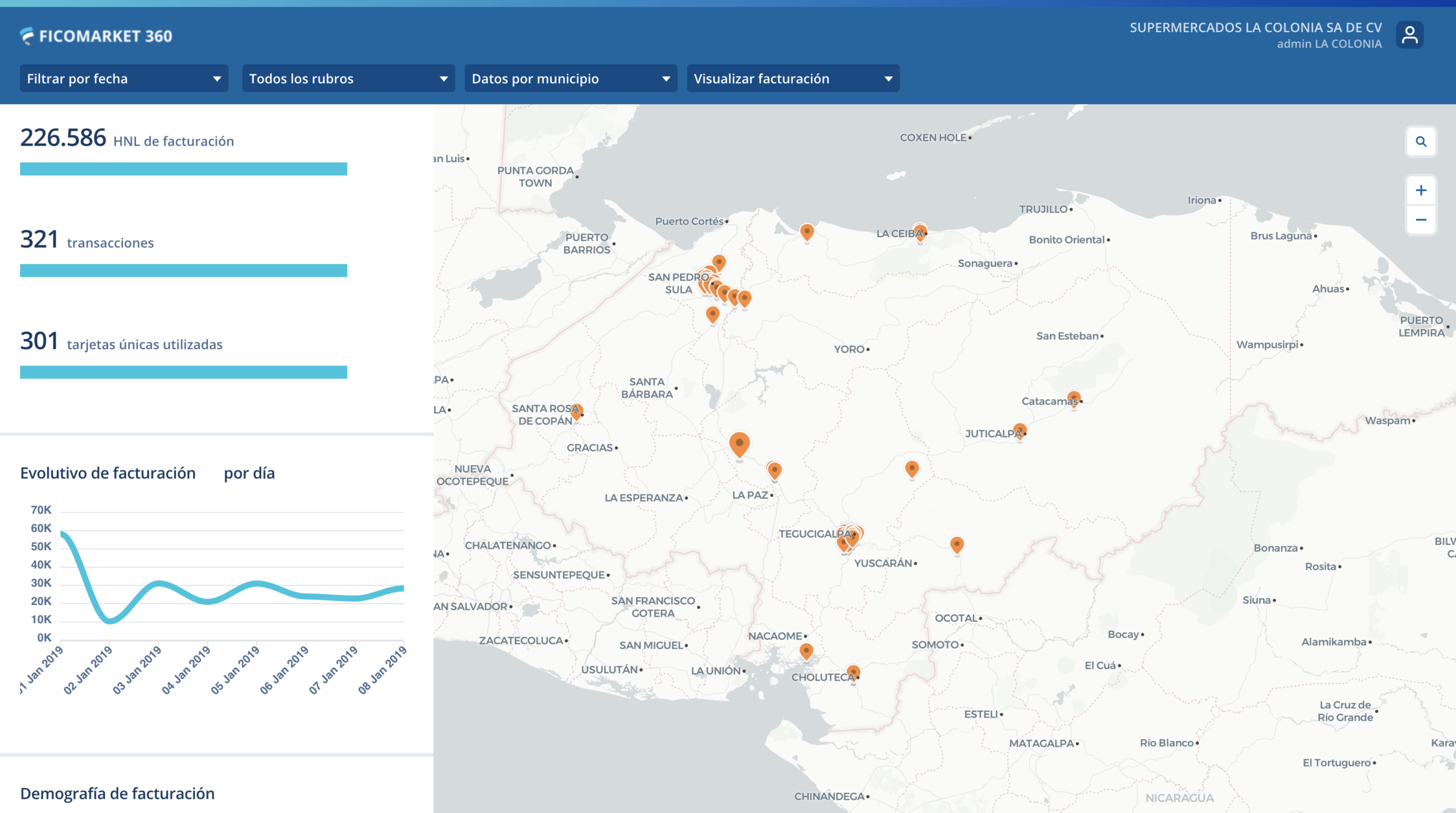
Compare locations
Discover the areas that meet the optimal indicators to launch your business.

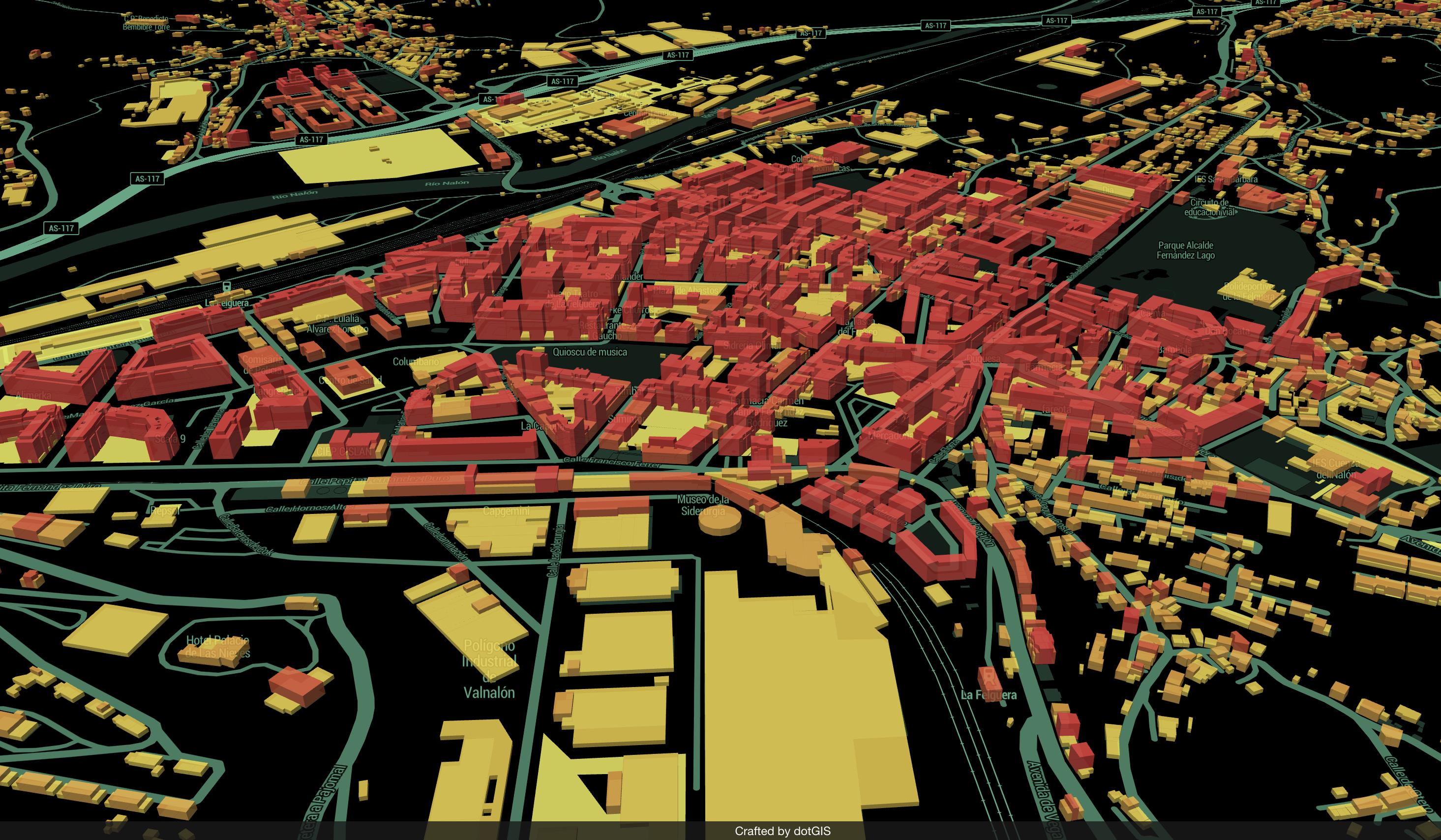
Twin Areas Analysis
With Location Intelligence techniques, you will be able to analyze the current locations of your business, those of your competitors and new locations in a visual and intuitive manner.

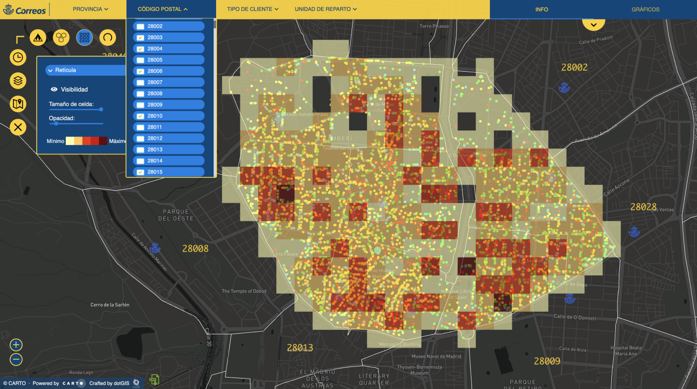
Optimal locations
Identify the factors that drive or slow down your business, and look for the areas that meet the best conditions for its development. Make predictions based on data to take into account when expanding or optimizing your points of sale network.
Do you have a challenge and don't know how to face it?
What our clients say about us
With DOTGIS we were able to spotlight the quality and speed of our service. They adapted to our needs and created the perfect functionalities for our application.

DOTGIS has done a great job. They were totally committed to us and our project and they achieved high quality results. If I had to highlight something, it would be their closeness and how easy it was to work with them.

DOTGIS constantly helps us discover new insights in our business thanks to the use of maps. They are creative, fast and professional.

DOTGIS helped make this project happen in record time. We have created a tool that is useful for our clients and for society as a whole that has improved our place in the real estate world and has enabled us to increase sales.

Together with DOTGIS, we have developed a technology that uses satellite images to improve the management of the vegetation adjacent to power lines. This allows us to identify different species of trees or calculate the height of the trees in the area, but also estimate the growth potential of the tree mass.

All of this helps the promoter save on time, resources and cost. The value added is immediate and from the point of view of the user it offers a much better experience.

We have been committed to innovation for years and DOTGIS has allowed us to process millions of data from a new and efficient point of view. This is allowing us to convert the data into information that the entire company handles and that will improve our level of service, all in record time.

Industries we collaborate with
Real Estate

Reinvent the analysis of your assets to improve the profitability of your decisions through a Location Intelligence solution.
Retail

Better understand your consumers, their behavior, and make decisions based on real and up-to-date geolocated data.
Discover use cases
Utilities

Are you in the Utilities, Water or Gas sector? Harness the potential of your natural and business resources with a GIS solution.