

DAM
Efficient waste management for water purification plants.
Are you in the Utilities, Water or Gas sector? Harness the potential of your natural and business resources with a GIS solution.
Contact usDo you have a challenge and don't know how to face it?
![]()
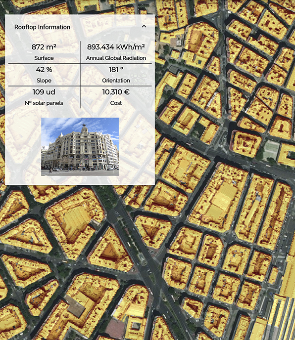
GIS solutions enable intelligent mapping and spatial analysis of specific locations through intelligent analysis of massive data.
Through this analysis, you will be able to develop models that take into account the characteristics of the terrain (slope, orientation, nature of the soil, etc.) that support decision-making in the design of electricity, water or gas distribution networks, environmental and socio-demographic factors.
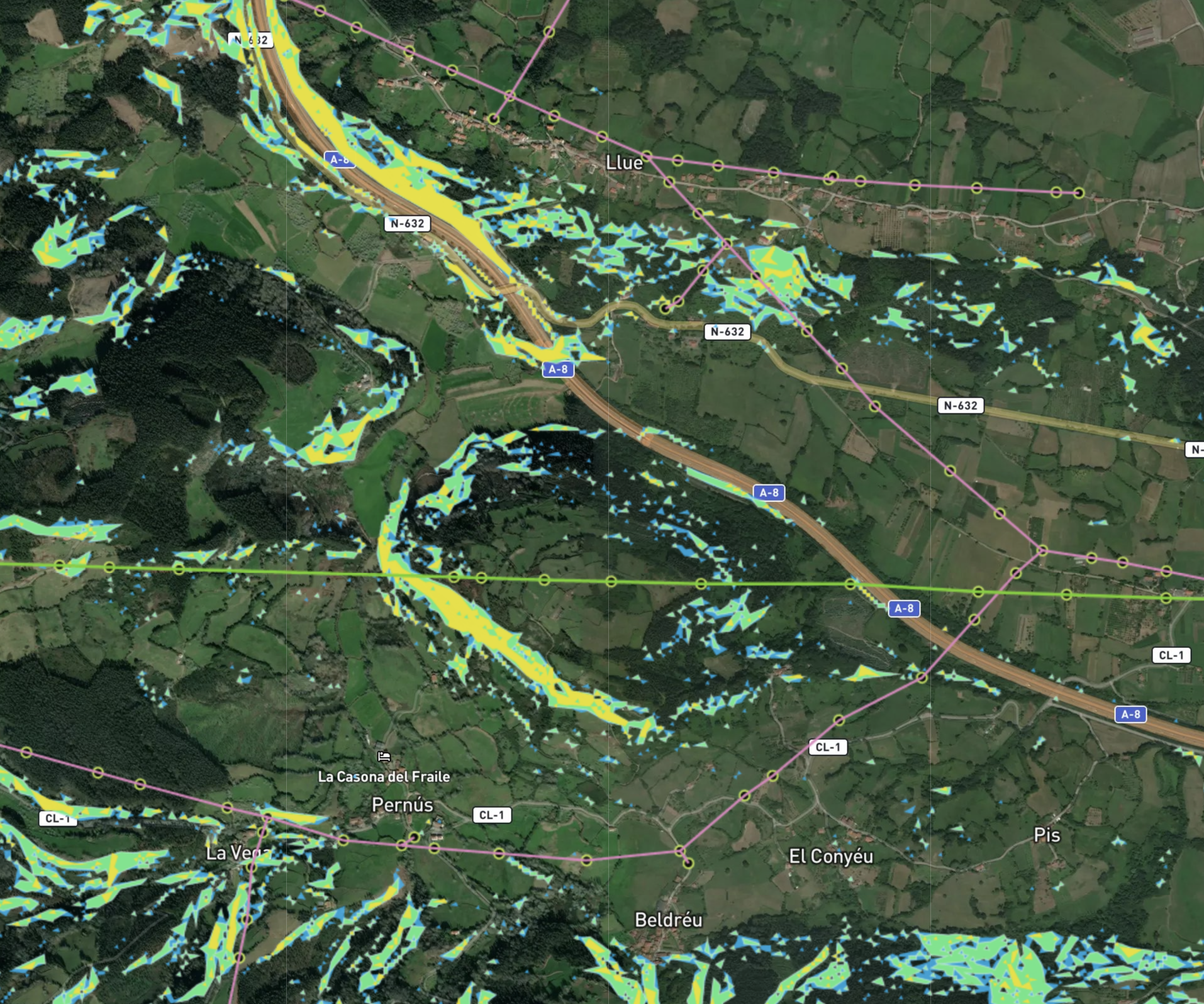
Risk management in the face of natural or anthropic phenomena will be easier with a holistic view of all risks and their possible evolution over time in the face of climate change scenarios.
Location data allows us to analyze the environment, prioritize actions, and develop energy generation and consumption models for the optimization of the supply/design process of related services.
GIS solutions allow you to aggregate, identify and forecast demand at each delivery point of your utilities services, making it easier to optimize the management of the logistics chain and the commissioning and delivery of the service.
You will be able to cross-reference data and simulate a sales forecast based on historical data and market environment conditions for a more concrete and realistic market analysis.
One of the main focuses of attention for any company in the utilities sector is to know how its assets are doing in real time.
To this end, the location factor provided by Geographic Information Services (GIS) makes it possible to develop ad hoc tools that monitor the assets of the distribution network in real time, identifying trends or patterns of previous behaviour, in order to make a report from the field or track the environment from satellite images, drastically reducing the investment in field work.
We combine your business data with GIS data from the environment to create a Location Intelligence solution that compiles this information into a dashboard for intuitive, visual access to vast amounts of historical and present data. This visualization combines maps and alphanumeric indicators with query, filtering, search and reporting, and other customizable tools.
Efficient waste management for water purification plants.
Smart Grids, the digital transformation of electrical networks.
Con el aumento del comercio mundial, el sector de la logística ha experimentado un incremento de...
¿Qué está sucediendo en el sector de los centros comerciales? ¿En qué medida han afectado los...
De “Cities” a “Smart cities”: El reto de digitalización que aún no cumplen muchas ciudades. No...
Do you have a challenge and don't know how to face it?