


Grupo Lar
BI platform, Rent Roll and indoor solution for shopping centers
Reinvent the analysis of your assets to improve the profitability of your decisions through a Location Intelligence solution.
Contact usDo you have a challenge and don't know how to face it?
![]()
For companies in the Real Estate sector, making quick decisions and minimizing risks is a key.
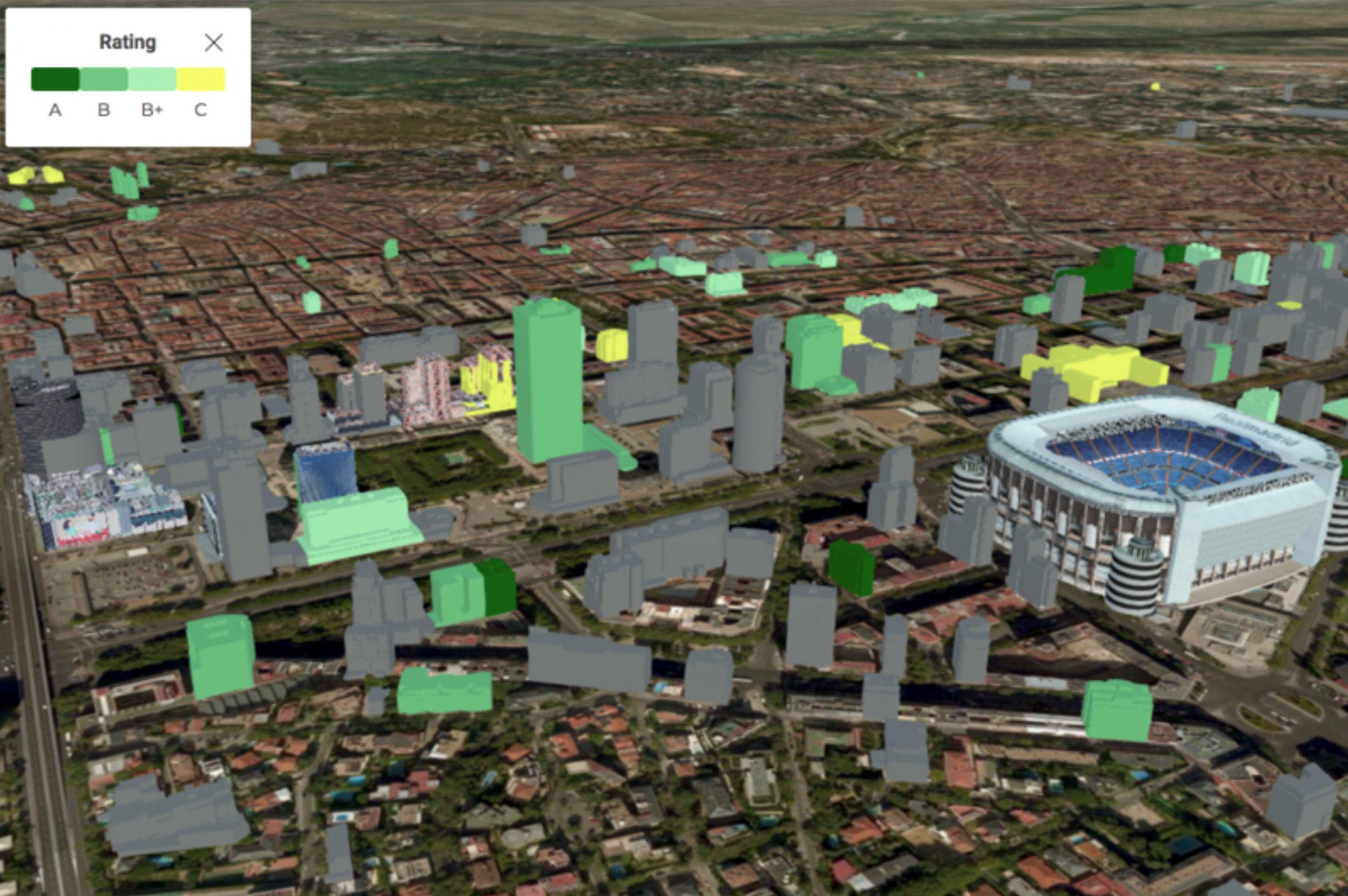
Integrating the vast amounts of data available into a GIS platform allows analysis of the environment to understand the weaknesses and strengths of real estate assets. This holistic view instantly and aesthetically provides valuable environmental information to carry out economic valuations of Real Estate asset portfolios, all in an agile and robust manner.
Geographic Information Systems (GIS) allow you to compare locations and discover the areas that meet the optimal indicators you are looking for in the development of your business, identifying the locations on which to focus the sales force.
GIS solutions for the Real Estate sector also allow the analysis of sales activity and buyer behavior based on their profile. This analysis, as well as sales prediction tools, are essential to analyze sales volume based on the company’s historical data and the characteristics of the environmental conditions of the market in which it operates.
By integrating artificial intelligence techniques, this solution allows you to make sales predictions based on historical data from your Real Estate company, and model the characteristics and conditions of the market. With this, you can better plan your sales, franchises, distribution and marketing.
Through monitoring assets and people by combining IoT and Computer Vision technologies, in which all information on user behavior obtained is detailed, we can optimize the operation and management of spaces.
Using Geographic Information Systems (GIS), we can develop ad hoc tools that monitor in real time the information and activity of assets, whether in outdoor or indoor locations, calculating routes and carrying out guidance through different enclaves, taking into account areas with more or less pedestrian traffic.
We combine your business data with GIS data from the environment to create a Location Intelligence solution that compiles this information into a dashboard with descriptive KPIs that allow you to review, compare, and create reports based on updated data in a visual and intuitive way.This visualization combines maps and alphanumeric indicators with query, filtering, search and reporting, and other customizable tools for agile management.
BI platform, Rent Roll and indoor solution for shopping centers
Location Analytics to help users find their ideal neighborhood when planning to move.
Con el aumento del comercio mundial, el sector de la logística ha experimentado un incremento de...
¿Qué está sucediendo en el sector de los centros comerciales? ¿En qué medida han afectado los...
De “Cities” a “Smart cities”: El reto de digitalización que aún no cumplen muchas ciudades. No...
Do you have a challenge and don't know how to face it?