The Valencia Regional Government
Online maps and Location Intelligence for the creation of an APP for “Bany CV Areas.”
About the company
The Community of Valencia is one of the most visited regions in Spain and receives tourists regularly. During the de-escalation phase of the Covid-19 pandemic one of the most essential aspects of this phase was to offer information to visitor so that they could feel safe and they could enjoy coming to this region again.
Challenges
The Valencia Regional Government requested from the General Directorate to commission the Advancement of the Digital Society and put them in charge of the Valencian company Play&Go Experience, a web / app that has the aim of providing citizens with a visualization system of the degree of occupation of the beaches and other sun bathing areas of the Valencian Community, to face the Post Covid-19 tourist season with the maximum security guarantees.
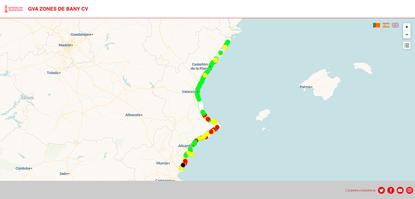
The biggest challenge was to develop a platform that could geolocate the 340 beaches and coves on the cost of the Community, as well as the inland sunbathing areas and offer all this information in real time.
Solution
Play & Go Experience is a company with which we here at DOTGIS coincided with at the 5th Edition of the Lanzadera Program. They contacted us to collaborate on the development of the project. Together during this time, we decided to opt for the technology of the CARTO company to have online maps and Location Intelligence solutions. The web / app “Bany CV areas” allows:
- The visitor feels safe when it comes to enjoying sunbathing areas and even discovering new areas.
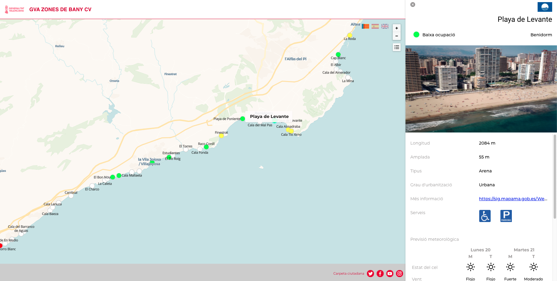
- Daily capacity status: It is indicated with a simple color code similar to those of the beach flags: green (low occupancy), yellow (medium occupancy), red (full occupancy). It also indicates if there is no data (white), or if it is closed (black).
- Information updated daily and throughout the day through a manual data collection system in which the zone managers indicate the occupation status on this same map.
- Specific detail of the characteristics of the area: Municipality to which it belongs, if it has a blue flag, length, width, type of sand, levels of urbanization, if it has accessibility and parking services and a link to more information on that area on the website of the Ministry of Ecological Transition, which is the one who provides this information.
- Weather forecast: For the next few days, with the state of the sky, wind, waves, maximum temperature, thermal sensation, water temperature and maximum UV index, all directly from the official website of the State Meteorological Agency (AEMET).
- Place reservation: In the event that the sunbathing area has a place reservation website or a tourist website, it will also be shown with two buttons to access directly.
Do you have a challenge and don't know how to face it?