Madrid City Council – Taxi
Location Intelligence APP for Taxi services in the Community of Madrid
About the company
The Madrid City Council is not exempt from the digital transformation process that focuses on offering citizens more accessible and reliable services in line with the current times. Within this transformation, the chosen one has been the taxi sector, developing a solution for both professionals and travelers.
Challenges
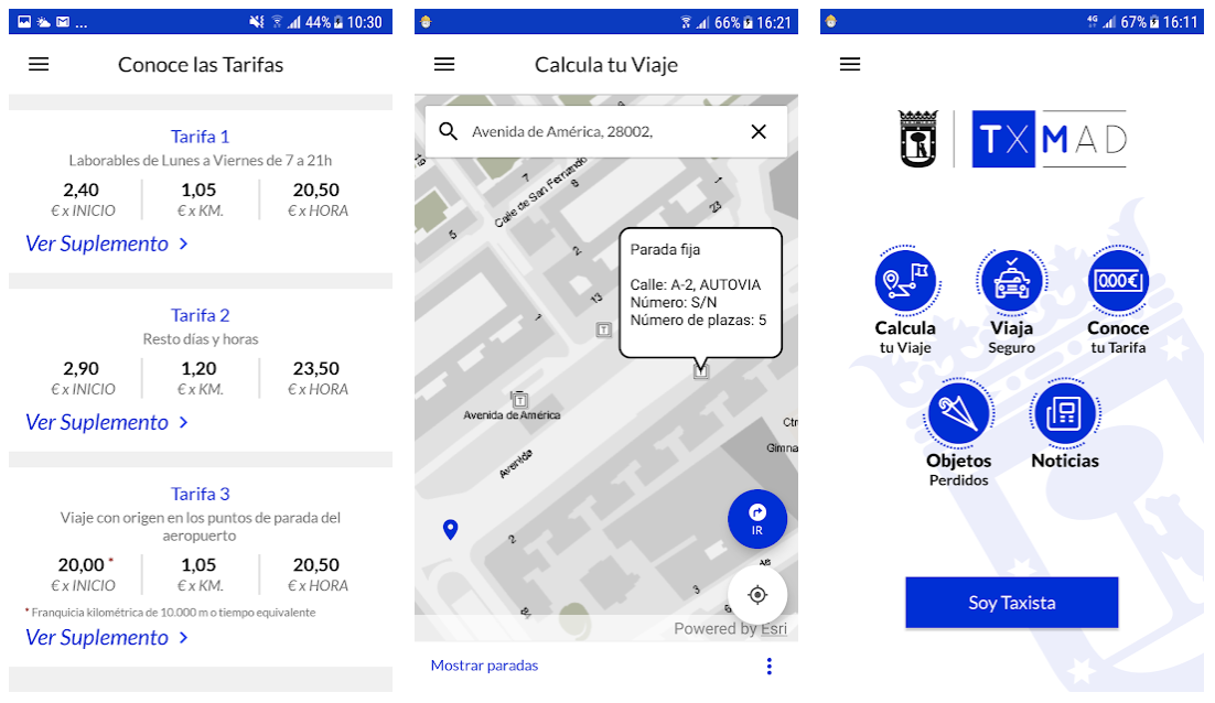
The Madrid City Council wanted to develop an application aimed at achieving taxi services that were managed more intelligently, services that would benefit both the taxi drivers themselves as well as the citizens. The biggest challenges that arose were: provide the taxi driver with an app from which they could manage their licenses and daily activity in a more agile and efficient way and also, to offer citizens an app from which to consult all aspects of the public taxi service in order for them to have more confidence in these services.
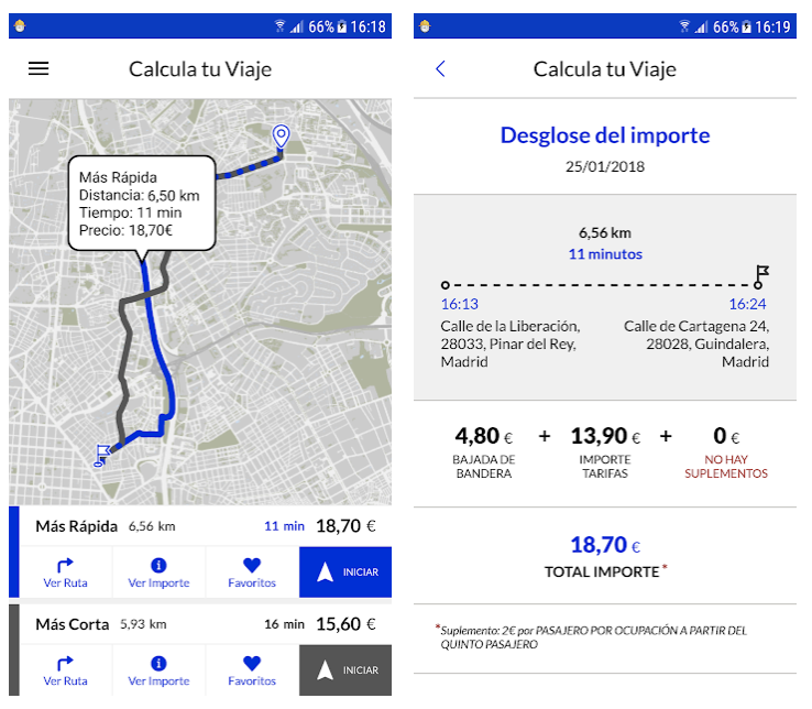
The challenge was to use the power of Location Intelligence so that both the taxi drivers and users would benefit from a complete, secure and true application.
Solution
DOTGIS, has integrated a series of components into the GIS platform of the Madrid City Council, based on ESRI’s ArcGIS platform, that extend the capabilities of the proposed application and that allow:
- Calculation of faster and shorter routes.
- Integration of traffic data in real time.
- Tools for finding and calculating the route to nearby points of interest (taxi stops, leisure and cultural centers, health facilities such as hospitals and health centers, among others)
- Real-time monitoring of the route followed by the taxi.
Do you have a challenge and don't know how to face it?